|
Bmblbzzz
|
 |
« Reply #195 on: February 25, 2020, 20:57:38 » |
|
Once a week I do a shift in a charity bookshop (cos who wouldn't want to spend a morning drinking tea, chatting to people, playing the boss's Led Zeppelin LPs, all while surrounded by books, and being able to delude yourself that you're helping to make the world a tiny bit better?). Most purchases are small sums – rarely into double digits – but at least two thirds of payments are electronic in one form or another. There no longer seems to be a generational divide in this, either, except in the actual technology used (young people use phones, old people use smart watches, those between use cards – generalisation, obviously) and maybe the choice of bank/financial service provider.
|
|
|
|
|
 Logged
|
Waiting at Pilning for the midnight sleeper to Prague.
|
|
|
|
bleeder4
|
 |
« Reply #196 on: February 27, 2020, 20:08:32 » |
|
Rather an amusing flyer received in the post today, which I've attached to this post. I assume the whole of Worcester received it. A couple of glaring errors. It claims that this is the first time we have had a direct rail connection to London and Oxford, which is of course nonsense, and the map labels the motorway bordering Worcester as being the M4 instead of the M5. Anyone coming off at M4 Jn7 as this flyer suggests would have one heck of a drive ahead of them!
|
|
|
|
|
 Logged
|
|
|
|
|
grahame
|
 |
« Reply #197 on: March 14, 2020, 19:15:16 » |
|
Pictures of Worcestershire Parkway (well - only seen a very few here!) 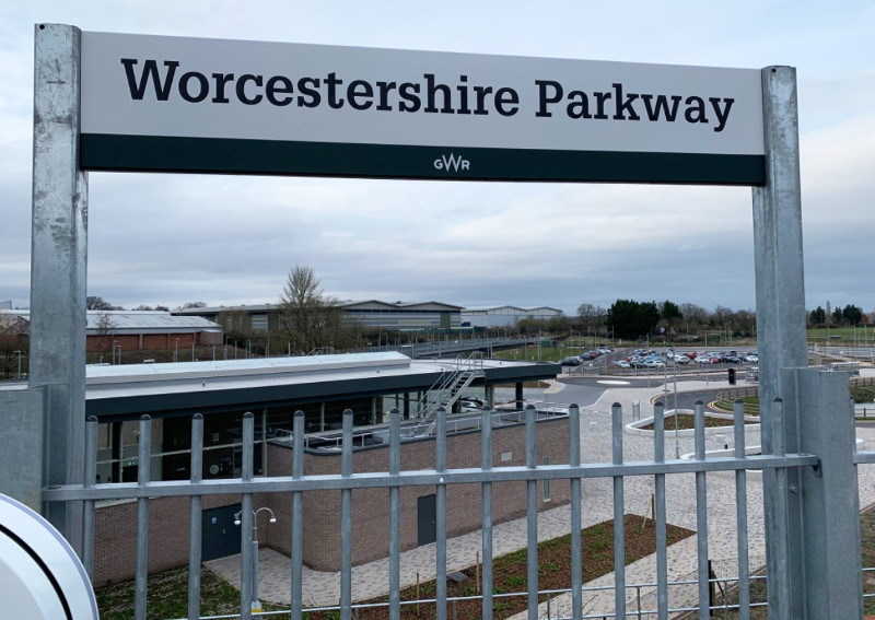 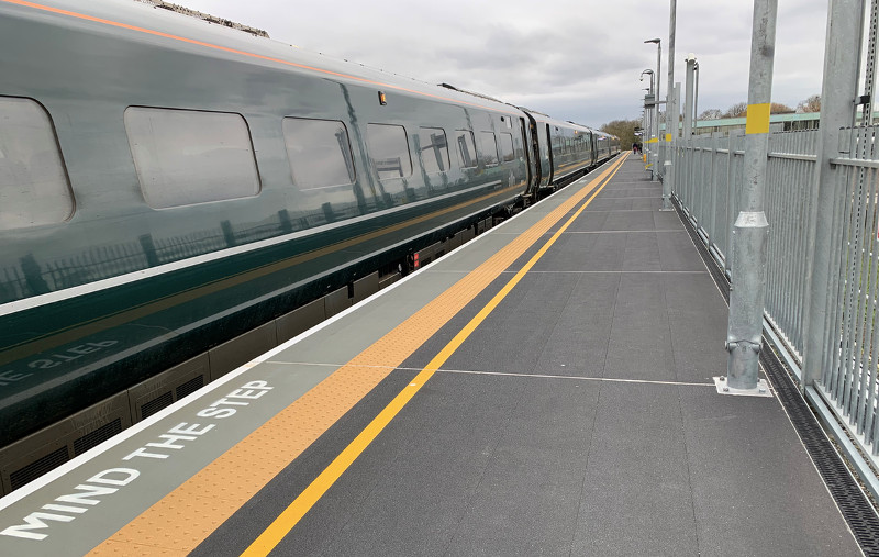 London train at platform 3 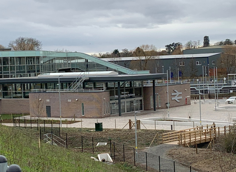 View of the station enrtrance fro platform 3 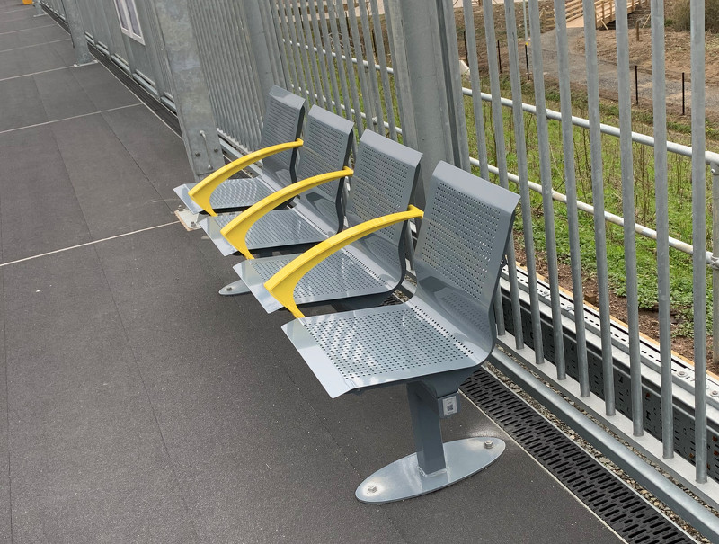 Seats on platform 3 - very exposed and just about the only seats around 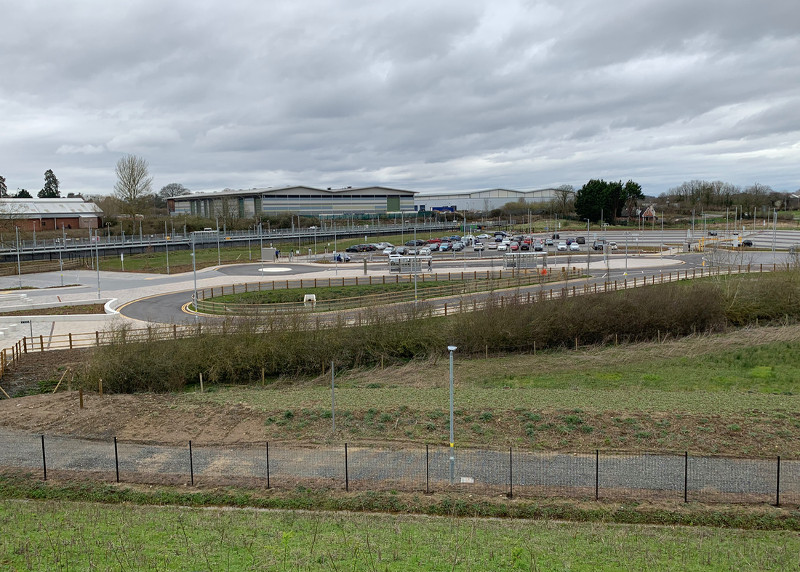 A quiet Saturday scene. I understand initial traffic is commuter traffic, with Birmingham most popular destination so far 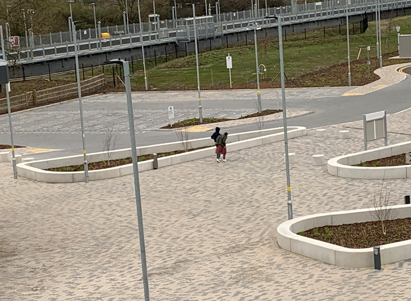 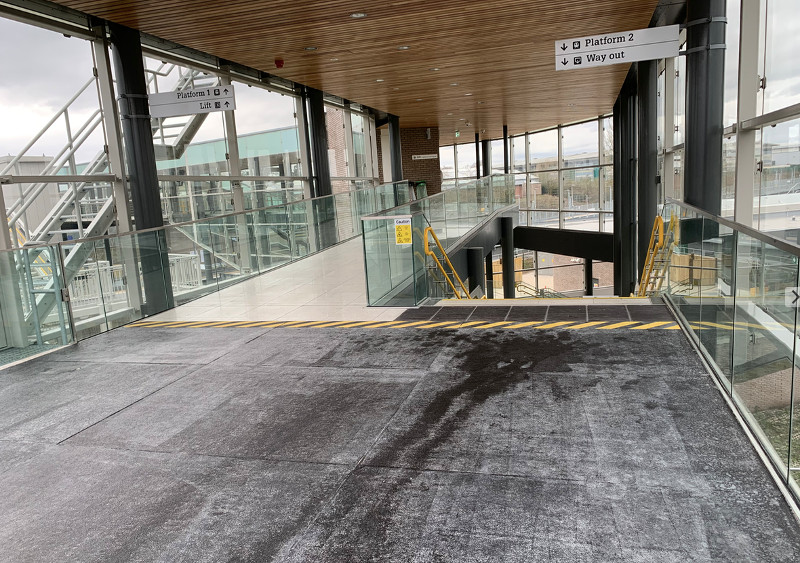 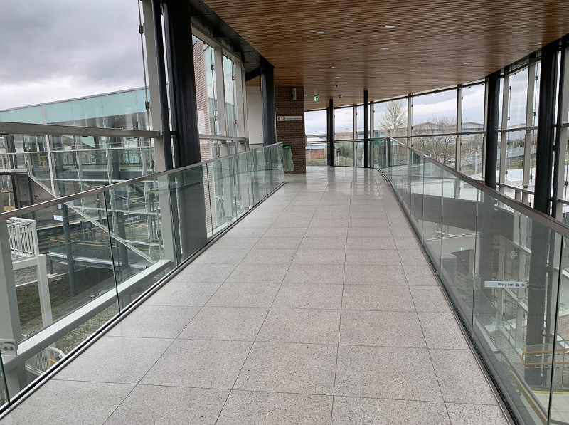 Level off platform 3, passes over the Cheltenham to Birmingahm line 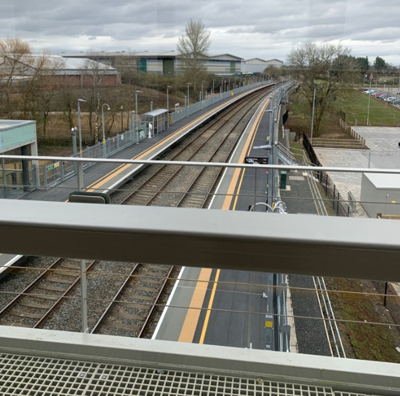 Platforss 1 and 2, where Cardiff to Nottingham services call, and Bristol and Manchester services race through 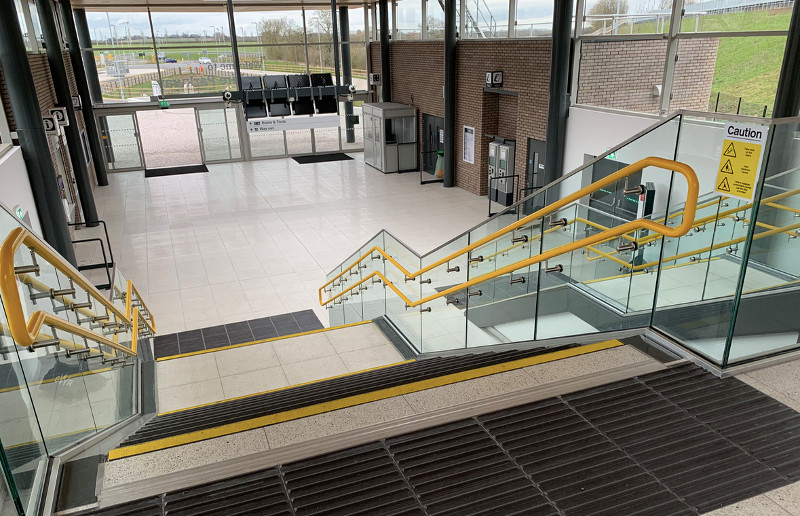 What - no seats. No buffet either. Both on order! 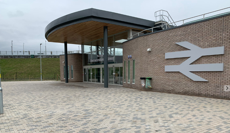 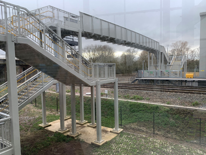 Public footpath bridge. Does not appeat to be wheelchair accessible (in fact you need to be darned fit!) 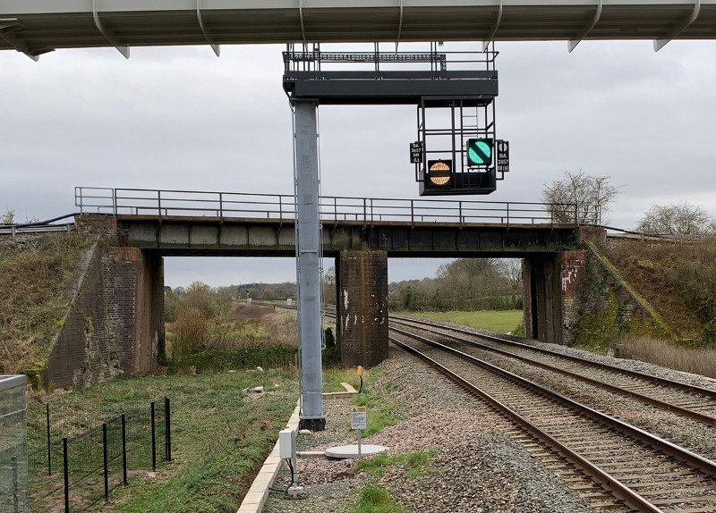 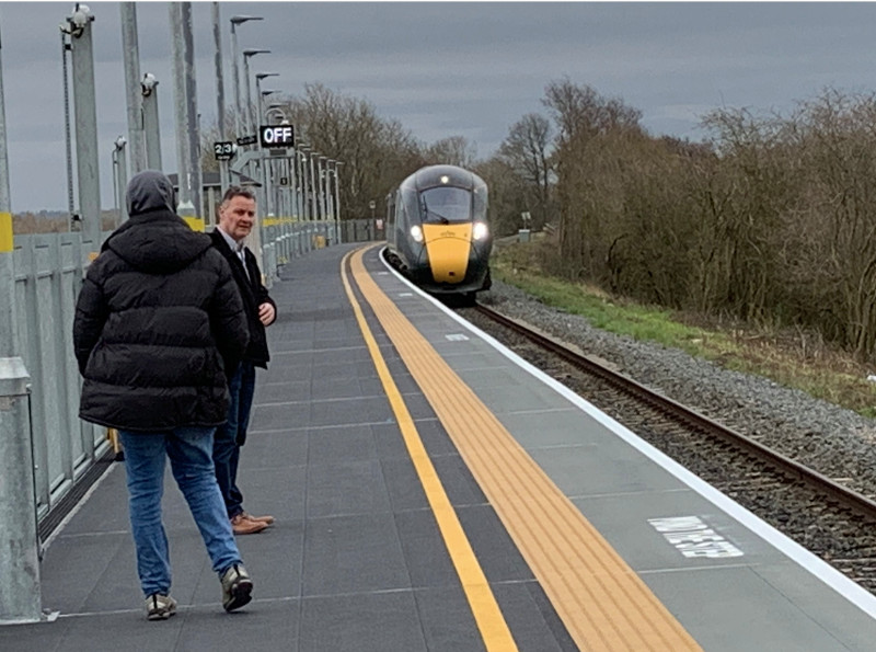 My next train arrives! |
|
|
|
|
 Logged
|
Coffee Shop Admin, Chair of Melksham Rail User Group, TravelWatch SouthWest Board Member
|
|
|
|
JayMac
|
 |
« Reply #198 on: March 14, 2020, 20:32:15 » |
|
|
|
|
|
|
 Logged
|
"Good news for regular users of Euston Station in London! One day they will die. Then they won't have to go to Euston Station ever again." - David Mitchell
|
|
|
|
grahame
|
 |
« Reply #199 on: March 14, 2020, 21:20:00 » |
|
Great minds think alike grahame. I did tell you I'd be visiting Worcestershire Parkway today too. I came in down the North Cotswold Line. I guess you arrived on the Bristol-Birmingham Line
Each our own pictures. I had been up Worcestershire Beacon from Great Malvern ... came back planning to change onto a Cross Country Cardiff service. Sadly that was cancelled, so back up to Shrub Hill after a brief visit to Parkway and the onto the GWR▸ Westbury train ... Exhausted. Done more walking today than I've even done since I lost my balance / hearing on one side. First time up the Beacon for 40 years! |
|
|
|
|
 Logged
|
Coffee Shop Admin, Chair of Melksham Rail User Group, TravelWatch SouthWest Board Member
|
|
|
|
JontyMort
|
 |
« Reply #200 on: March 14, 2020, 23:07:05 » |
|
Great minds think alike grahame. I did tell you I'd be visiting Worcestershire Parkway today too. I came in down the North Cotswold Line. I guess you arrived on the Bristol-Birmingham Line
Each our own pictures. I had been up Worcestershire Beacon from Great Malvern ... came back planning to change onto a Cross Country Cardiff service. Sadly that was cancelled, so back up to Shrub Hill after a brief visit to Parkway and the onto the GWR▸ Westbury train ... Exhausted. Done more walking today than I've even done since I lost my balance / hearing on one side. First time up the Beacon for 40 years! It’s quite a pull up! The photo from the lower level of the Midland passing under the GW» is interesting, as it has an extra bridge on the Down side, with apparently space for two tracks. I’ve never noticed it before. Was there a loop there? |
|
|
|
|
 Logged
|
|
|
|
|
IndustryInsider
|
 |
« Reply #201 on: March 15, 2020, 00:33:20 » |
|
The photo from the lower level of the Midland passing under the GW» is interesting, as it has an extra bridge on the Down side, with apparently space for two tracks. I’ve never noticed it before. Was there a loop there?
I wondered that, too. There's a loop which starts a little further south of the station, so perhaps that used to be longer? |
|
|
|
|
 Logged
|
To view my GWML▸ Electrification cab video 'before and after' video comparison, as well as other videos of the new layout at Reading and 'before and after' comparisons of the Cotswold Line Redoubling scheme, see: http://www.dailymotion.com/user/IndustryInsider/ |
|
|
|
stuving
|
 |
« Reply #202 on: March 15, 2020, 08:40:16 » |
|
The photo from the lower level of the Midland passing under the GW» is interesting, as it has an extra bridge on the Down side, with apparently space for two tracks. I’ve never noticed it before. Was there a loop there?
I wondered that, too. There's a loop which starts a little further south of the station, so perhaps that used to be longer? No sign of that on old maps - rather that the bridge was built to allow for quadrupling that never happened. It may be hard to recreate now the thought processes that led anyone to expect that would ever be needed on the Bristol & Birmingham - but times change! |
|
|
|
|
 Logged
|
|
|
|
|
Bmblbzzz
|
 |
« Reply #203 on: March 15, 2020, 10:46:25 » |
|
Are we talking about this photo? I'm no engineer but I note the tracks are on a slight embankment, with no sign of that ever having been wide enough for four tracks. I don't know how significant that might be but could it be that the bridge was made wider in order to allow non-rail access? Vehicles for maintenance or maybe for farm access? |
|
|
|
|
 Logged
|
Waiting at Pilning for the midnight sleeper to Prague.
|
|
|
|
ellendune
|
 |
« Reply #204 on: March 15, 2020, 13:08:52 » |
|
Could it provide a cheap underpass if the North Cotswold line was ever double tracked at this point?
|
|
|
|
|
 Logged
|
|
|
|
|
stuving
|
 |
« Reply #205 on: March 15, 2020, 13:17:12 » |
|
Are we talking about this photo? I'm no engineer but I note the tracks are on a slight embankment, with no sign of that ever having been wide enough for four tracks. I don't know how significant that might be but could it be that the bridge was made wider in order to allow non-rail access? Vehicles for maintenance or maybe for farm access?
Who knows? It was a long time ago - around 1850. I suspect it was one of the horses traded between the OW&WR (who built the bridge) and the B&GR/ MR▸ (which was there first). They were also "collaborating" over the loop line via Worcester and on to Bromsgove at the time. In any case, it doesn't seem likely you would build the formation in advance of needing it. And the nearest bridge over a road isn't far away, so an accommodation bridge doesn't look likely. It also looks to me like it was originally spanned with timber, and so needed replacing pretty soon. |
|
|
|
|
 Logged
|
|
|
|
|
|
|
JontyMort
|
 |
« Reply #207 on: March 15, 2020, 17:37:54 » |
|
Interesting. One thing that map does illustrate neatly - at 25 inches to the mile - is the very short distance from Norton Junction to the new station, and how incredibly short-sighted it was not to re-double the few chains concerned in conjunction with a second platform as part of the scheme. This is particularly the case when we learn that there are proposals to extend the redoubling from Evesham West to Pershore - which would probably not be needed if Pershore remained the only station on the single-track section. |
|
|
|
|
 Logged
|
|
|
|
|
TonyN
|
 |
« Reply #208 on: March 16, 2020, 15:45:12 » |
|
The Attached snapshot from the OS▸ map shows that the extra bridge span was for a farm track that was also a Public Bridleway. This ran to a foot crossing further south. Looking at the Current Worcestershire county council footpath mapping https://gis.worcestershire.gov.uk/website/countryside/ the Bridleway and foot crossing have now been closed. |
|
|
|
|
 Logged
|
|
|
|
|
grahame
|
 |
« Reply #209 on: March 16, 2020, 16:42:35 » |
|
The Attached snapshot from the OS▸ map shows that the extra bridge span was for a farm track that was also a Public Bridleway. This ran to a foot crossing further south. Looking at the Current Worcestershire county council footpath mapping https://gis.worcestershire.gov.uk/website/countryside/ the Bridleway and foot crossing have now been closed. Interesting map - it also shows the path that remains open and that has been bridged for pedestrians within the new station. Welcome to the forum, TonyN. Your home area?? |
|
|
|
|
 Logged
|
Coffee Shop Admin, Chair of Melksham Rail User Group, TravelWatch SouthWest Board Member
|
|
|
|

